
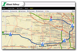
 The Illinois Tollway Web Map
Illinois Tollway Web Map is an interactive map designed to assist customers in finding location-specific information, including:
- Traffic cameras
- Trip calculator (moved)
- Toll rates by plaza
- Mileposts
- Oases
- Daily and long-term lane closures
Traffic Cameras
The Illinois Tollway Virtual Map allows customer to select from 15 camera locations throughout the Illinois Tollway system and view current roadway images. Most cameras offer customers multiple roadway views for each location.
Click on the "Traffic Cameras" tab located in the left navigation bar on the Illinois Tollway Virtual Map to identify camera locations.
Camera images are uploaded approximately every five minutes, and viewers must refresh the page to view updates. Image quality is dependent on weather conditions.
Trip Calculator
The Trip Calculator has moved to www.getipass.com/trip-calculator
Toll Rates by Plaza
The Illinois Tollway collects tolls at both mainline and ramp toll plazas throughout the Tollway system. Toll Rates by Plaza identifies the location and toll rates for all toll collection points on the system. Each location is identified by a toll plaza number. Clicking on a specific toll plaza icon will provide details including plaza number, location and the passenger vehicle toll rate for both I-PASS and cash customers. A link to the full toll rate chart for all vehicles, as well as a link to pay unpaid tolls online are also offered.
Mileposts
Milepost signs are located every quarter mile along the Illinois Tollway system and identify the interstate designation, direction of travel, as well as the milepost number. These signs provide customer assistance and help emergency responders better identify locations on the Illinois Tollway.
Oases
Seven Illinois Tollway Oases are located along the Tollway system and provide customers with fuel and a variety of services and food options. Each Oasis is identified on the Illinois Tollway Virtual Map by a fuel and food icon that provides the name and location of the Oasis and a link to a detailed list of tenants and hours of operation.
Daily Lane Closures
Daily Lane Closures are posted each week day and provide drivers with a list of temporary lane and shoulder closures and long-term closures by roadway. All closures are subject to weather conditions.
Construction
Construction points provide the location of current and future improvement projects.
Legal Disclaimer
The Illinois Tollway uses map overlay information from non-Tollway sources and is thus not responsible for the accuracy of the information on this website