
Downloads
Information contained herein is provided for informational purposes only. The Illinois State Toll Highway Authority (ISTHA) provides Geographic Information Systems (GIS) data, maps, and metadata with no claim as to the completeness, usefulness, or accuracy of its content, positional or otherwise.
Currently all downloads are in ESRI shapefile format. In the future, additional relevant data will be available in OGC compliant Simple Geo RSS format. This data will be available on a subscription basis.
- ADT 1970
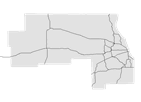 Line features representing the average daily traffic flow (ADT) volumes in 1970 at key interchanges on the Illinois Tollway. Attributes include name of tollway, segment, vehicle count, and others. Coordinate system is NAD_1983_StatePlane_Illinois_East. Geometry type is Line. Format is ESRI Shapefile.
- Download (64kb)
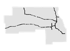
- ADT 2000
- Line features representing the average daily traffic flow (ADT) volumes in 2000 at key interchanges on the Illinois Tollway. Attributes include name of tollway, segment, vehicle count, and others. Coordinate system is NAD_1983_StatePlane_Illinois_East. Geometry type is Line. Format is ESRI Shapefile.
- Download (105kb)
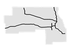
- ADT 2001
- Line features representing the average daily traffic flow (ADT) volumes in 2001 at key interchanges on the Illinois Tollway. Attributes include name of tollway, segment, vehicle count, and others. Coordinate system is NAD_1983_StatePlane_Illinois_East. Geometry type is Line. Format is ESRI Shapefile.
- Download (105kb)
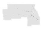
- ADT 2002
- Line features representing the average daily traffic flow (ADT) volumes in 2002 at key interchanges on the Illinois Tollway. Attributes include name of tollway, segment, vehicle count, and others. Coordinate system is NAD_1983_StatePlane_Illinois_East. Geometry type is Line. Format is ESRI Shapefile.
- Download (105kb)
- ADT 2003
- Line features representing the average daily traffic flow (ADT) volumes in 2003 at key interchanges on the Illinois Tollway. Attributes include name of tollway, segment, vehicle count, and others. Coordinate system is NAD_1983_StatePlane_Illinois_East. Geometry type is Line. Format is ESRI Shapefile.
- Download (105kb)
- ADT 2004
- Line features representing the average daily traffic flow (ADT) volumes in 2004 at key interchanges on the Illinois Tollway. Attributes include name of tollway, segment, vehicle count, and others. Coordinate system is NAD_1983_StatePlane_Illinois_East. Geometry type is Line. Format is ESRI Shapefile.
- Download (105kb)
- ADT 2005
- Line features representing the average daily traffic flow (ADT) volumes in 2005 at key interchanges on the Illinois Tollway. Attributes include name of tollway, segment, vehicle count, and others. Coordinate system is NAD_1983_StatePlane_Illinois_East. Geometry type is Line. Format is ESRI Shapefile.
- Download (106kb)
- Bridges
 Point features representing locations of bridges along the Tollway. Attributes include name of bridge, deck width, crossing and structure type and others. Coordinate system is NAD_1983_StatePlane_Illinois_East. Geometry type is Point. Format is ESRI Shapefile.
- Download (69kb)
- Interchanges
 Locations of interchanges along the Illinois Tollway system. Attributes include name, nearest milepost, nearest tollway and others. Coordinate system is NAD_1983_StatePlane_Illinois_East. Geometry type is Point. Format is ESRI Shapefile.
- Download (12kb)
- Mainline Plazas
 Mainline plazas are defined as toll plazas which are located on mainline segments of the Illinois Tollway and collect tolls from all vehicles passing through the plaza. Attributes include plaza name, plaza number, mile post, and others. Coordinate system is NAD_1983_StatePlane_Illinois_East. Geometry type is Point. Format is ESRI Shapefile.
- Download (8kb)
- Maintenance Yards
- This dataset shows the locations of the Illinois Tollway maintenance yard locations. Attributes include location, yard ID, and others. Coordinate system is NAD_1983_StatePlane_Illinois_East. Geometry type is Point. Format is ESRI Shapefile.
- Download (8kb)
- Mile Markers
 Location of milestone markers placed along the Illinois Tollway. Attributes include milepost, nearest tollway and others. Coordinate system is NAD_1983_StatePlane_Illinois_East. Geometry type is Point. Format is ESRI Shapefile.
- Download (43kb)
- Oases
 Locations of over-the-road pavilions along the Illinois Tollway system. Attributes include oasis name, nearest milepost, nearest tollway and others. Coordinate system is NAD_1983_StatePlane_Illinois_East. Geometry type is Point. Format is ESRI Shapefile.
- Download (13kb)
- Towers
- Locations of over-the-road pavilions along the Illinois Tollway system. Attributes include oasis name, nearest milepost, nearest tollway and others. Coordinate system is NAD_1983_StatePlane_Illinois_East. Geometry type is Point. Format is ESRI Shapefile.
- Download (14kb)
- Plaza / Toll Rates
- Locations of barrier plazas where tolls are collected. Attributes include location, nearest milepost, nearest tollway and others. Coordinate system is NAD_1983_StatePlane_Illinois_East. Geometry type is Point. Format is ESRI Shapefile.
- Download (21kb)
- Ramps
 Location of on and off ramps along the Illinois Tollway. Attributes include direction, route, nearest milepost, nearest tollway and others. Coordinate system is NAD_1983_StatePlane_Illinois_East. Geometry type is Line. Format is ESRI Shapefile.
- Download (21kb)
- Reference Line
- Linear features representing the Illinois Tollway system Attributes include Tollway name and others. Coordinate system is NAD_1983_StatePlane_Illinois_East. Geometry type is Line. Format is ESRI File Based Geodatabase.
- Download (211kb)
- South Extension Ramps
- This dataset shows the locations of ramps along the I-355 South Extension. Attributes include tollway ID, interchange, and others. Coordinate system is NAD_1983_StatePlane_Illinois_East. Geometry type is Line. Format is ESRI Shapefile.
- Download (34kb)
- Survey Base Stations
- This dataset shows the locations of CORS stations in the Kara Company network that are owned by the Illinois Tollway. Attributes include relative and absolute location, station code, and others. Coordinate system is NAD_1983_StatePlane_Illinois_East. Geometry type is Point. Format is ESRI Shapefile.
- Download (8kb)